 NERC Data Catalogue Service
Mineral deposits
Type of resources
Topics
Keywords
Contact for the resource
Provided by
Years
Formats
Representation types
Update frequencies
Scale
-
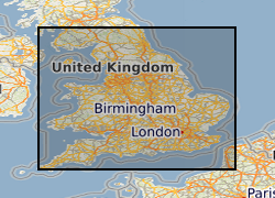
Between 2001 and 2003 BGS received approximately 1400 1:25 000 paper maps and associated card index from the Office of the Deputy Prime Minister (now Department for Communities and Local Government (CLG)). The maps, originally compiled by the Minerals Division of the Ministry of Housing and Local Government (CLGs historic predecessor), contain hand drawn boundaries for permitted, withdrawn and refused mineral planning permissions, and worked ground. They also contain hand drawn boundaries for land use at each site. These 'MHLG' maps show information collated from the 1940s (retrospectively to 1930) to the mid 1980s. The index cards provide supplementary information regarding name, operator, dates and relevant local authority. Data depicted on the maps are for England only and include; [a] all planning appeals, departures and called in cases whether permitted or refused; [b] all planning permission and refusal data for various local authority areas which were obtained by Departmental officials through visits to authorities in a staged programme spread over many years. Priority was placed on areas that were giving rise to then current casework issues thus at the time when the maintenance of the maps ended (mid 1985), some authority information had been updated recently but other areas had not been visited for many years. [c] land use present at each site. Categories include: derelict areas, restored quarries (filled and unfilled), tip heaps and spoil heaps, and wet areas. The variable completeness of the data sets should be kept in mind when this material is being used. Land use polygons have been digitised from the MHLG maps and attribute information has been provided from the map legend and the appropriate card in the card index. The principal aim of the data is to show land use present in areas of land that have been affected by the extraction of minerals.
-
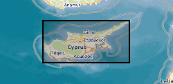
Geochemical and field data collected from samples from ore deposits hosted in the Troodos ophiolite, Cyprus by Dr Andrew Martin during his PhD. File T1 contains sample names, locations and description and file T2 contains photographs and field observations for sample localities. File T3 contains portable x-ray fluorescence (XRF) data from powdered Troodos ophiolite samples. Files T4 - T8 contain sulphide trace element data from laser-ablation inductively-coupled-plasma mass-spectrometry (LA-ICP-MS) analysis of samples from various deposits in the Troodos ophiotlite. Files T9 and T10 contain bulk sample geochemistry from aqua regia digest and ICP-MS for deposits from the Troodos ophiolite. File T11 contains results from conventional ä34S analysis of sulfide minerals from Troodos deposits and file T12 contains x-ray diffraction analysis data from silica-rich deposits in the Troodos ophiolite. Data is used in papers available at https://doi.org/10.1016/j.oregeorev.2019.01.024, https://doi.org/10.1180/mgm.2018.81 and https://doi.org/10.1016/j.chemgeo.2019.119325 and in Dr Andrew Martin's PhD thesis, available at http://orca.cf.ac.uk/124346/.
-

Mineralogical and geochemical data from sulphides and other ore minerals from the Skouries porphyry Cu-Au deposit, Greece. Samples were taken from several boreholes from the Skouries mine, courtesy of Eldorado Gold Corporation. This data contains petrological photographs; identification of platinum group minerals and precious metal minerals; and trace element concentration of ore minerals. This data was collected as part of the TeaSe consortium NERC grant in order to determine the concentration and hosting of critical and precious metals in various types of ore deposits and barren rocks from different geological environments. This data was collected and interpreted by researchers at Cardiff University and is used in a paper, available at https://doi.org/10.1016/j.oregeorev.2018.06.014.
-
Whole rock assay data for the El Teniente, Skouries and Muratdere porphyry Cu deposits. Samples were selected for analysis from boreholes in the Muratdere Cu-Au-Mo porphyry deposit, Western Turkey; and the Skouries Cu-Au porphyry deposit, Greece; and samples from the El Teniente Cu-Mo porphyry deposit were selected from the Natural History Museum London’s ore collection. This data contains whole rock assay data performed by ALS, comprising the whole rock concentration of metals and semi-metals from the three deposits. This data was collected as part of the TeaSe consortium NERC grant in order to determine the concentration and hosting of critical and precious metals in various types of ore deposits and barren rocks from different geological environments.
-

Sample locations and geochemical data from the Aurora Ni-Cu-PGE magmatic sulphide deposit, Northern Bushveld Complex, South Africa. Samples were taken from two boreholes on the La Pucella farm, courtesy of Pan Palladium Limited. This data contains petrological photographs; scanning electron microscope element maps and identification of platinum group minerals and precious metal minerals; and trace element concentration of ore minerals. This data was collected as part of the TeaSe consortium NERC grant in order to determine the concentration and hosting of critical and precious metals in various types of ore deposits and barren rocks from different geological environments. This data was collected and interpreted by researchers at Cardiff University and is used in a paper, available at https://doi.org/10.1016/j.oregeorev.2019.02.008.
-
This layer of the map based index (GeoIndex) shows the location of available Mineral Assessment Reports, the information for the index has been taken from the BGS UK Sand and Gravel Database. Each report studied the sand and gravel resources of an area of between one hundred and two hundred square kilometres. This layer shows individual polygons of the geographical areas covered by each report. Selecting the individual polygons via the map based index (GeoIndex) application gives details of the corresponding report title, number, author(s), subtitle and the date report was first published. The Department of the Environment commissioned this Report series from the British Geological Survey.
-
This dataset provides an overview of hydrothermal alteration samples from the island of Milos, Greece, that were analysed using a portable infrared mineral analyser (PIMA) or AgriSpec spectrometer. During data acquisition, spectrums were input into The Spectral Geologist (TSG) to provide an instant and estimated mineral identification using the shortwave infrared (SWIR) part of the electromagnetic spectrum. The samples were acquired during field visits between 2017 - 2019 by the British Geological Survey and the GW4+ Doctorial Training Partnership (NE/L002434/1). This data was primarily used to aid sample collection for further hydrothermal alteration analyses to improve our understanding of regional and local paleo-hydrothermal activity across the island. Identification by the TSG provides an estimation only, and the raw data files in .txt, .fos and .csv formats, are supplied for each analysis in the attached zipped file. This may be useful within the metallic and industrial mineral mining sector and associated researchers. The data includes grid references (± 5 m), TSG interpretations, and field/sample observations noted during data acquisition. GW4+ Doctoral Training Partnership (NE/L002434/1) is supported by grant award GA/09F/139 – RMS E3557, and the British Geological Survey’s University Funding Initiative (BUFI S345).
-

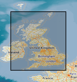
Reports of 267 mineral exploration projects carried out in the UK under the Mineral Exploration and Investigation Grants Act (MEIGA). Produced by external mineral exploration companies between 1971 and 1984. Includes project files kept on behalf of DTI (Department of Trade and Industry). All reports are held in hard copy and all are now on openfile.
-

Petrological and geochemical data of sulphides and samples from the Muratdere Cu-Au-Mo porphyry deposit, Turkey. Samples were taken from several boreholes from the Muratdere mine in Western Turkey, courtesy of Stratex International (now Oriole Resources). This data contains petrological photographs and trace element concentration of ore minerals. This data was collected as part of the TeaSe consortium NERC grant in order to determine the concentration and hosting of critical and precious metals in various types of ore deposits and barren rocks from different geological environments. This data was collected and interpreted by researchers at Cardiff University and is used in a paper, available at https://doi.org/10.5382/econgeo.4638.